Mount Meru, Tanzania’s second-highest peak at 4,562 meters (14,968 feet), is not only a hiker’s paradise but also a geological marvel. This dormant stratovolcano, located in Arusha National Park, presents a fascinating mix of volcanic formations, crater landscapes, lava flows, and ash deposits. Understanding its unique geology enriches the trekking experience and provides insight into the mountain’s formation, its surrounding ecosystem, and its connection to the Great Rift Valley.
Here’s your guide to the unique geological features of Mount Meru.
1. Stratovolcano Structure
Mount Meru is a classic stratovolcano, characterized by:
- Layers of lava, ash, and volcanic rocks built over hundreds of thousands of years
- Steep slopes formed from multiple eruptions
- A complex volcanic history that has shaped its current conical shape
Stratovolcanoes like Mount Meru are known for dramatic landscapes and challenging hiking terrain, making each trail a geological exploration.
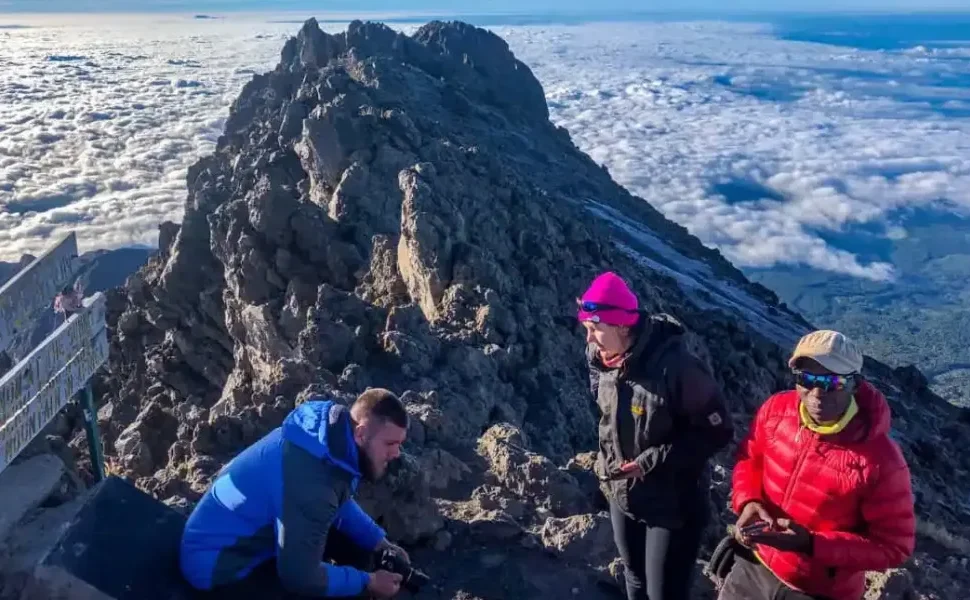
2. Crater and Crater Rim
One of Mount Meru’s most striking features is its crater, known as the Meru Crater:
- The crater spans approximately 2.2 kilometers in diameter
- Features a crater wall and caldera floor, with lush vegetation and occasional wildlife
- Saddle Hut sits near the crater rim, offering hikers panoramic views of volcanic formations and nearby peaks
- Provides insight into past volcanic activity, including explosive eruptions that shaped the surrounding landscape
The crater’s rugged beauty makes it a favorite spot for photography and geological observation.
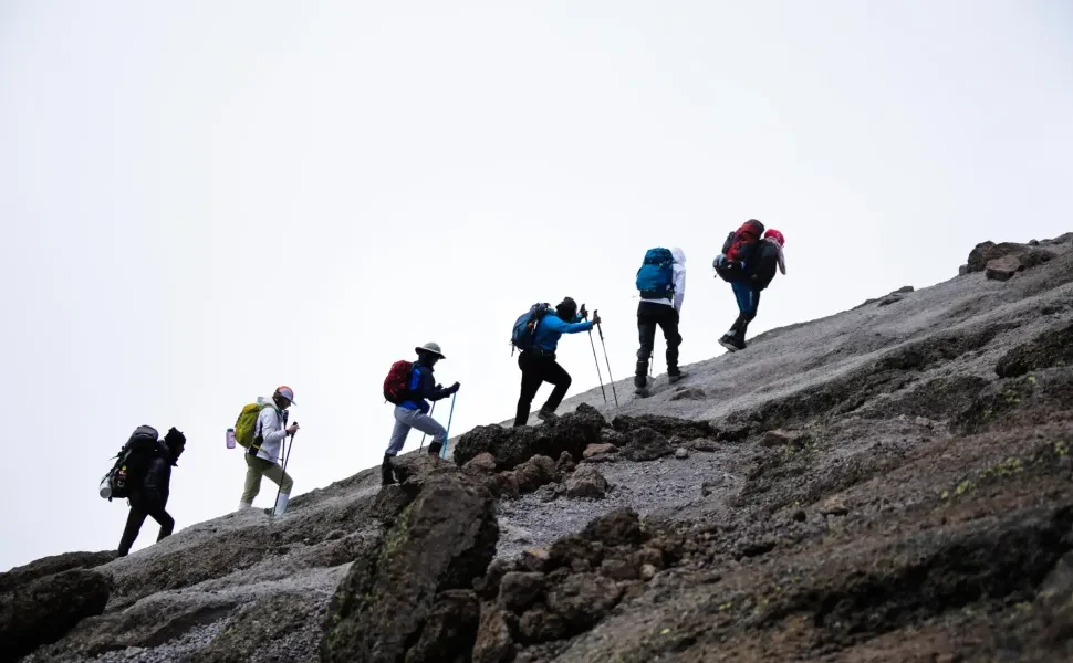
3. Lava Flows and Ash Deposits
Mount Meru’s slopes showcase layers of lava flows and volcanic ash, visible along the trekking trails:
- Solidified lava creates natural ridges and rocky outcrops
- Ash deposits contribute to fertile soils that support montane forests and alpine vegetation
- Different colored layers reveal the mountain’s eruption history, with older deposits darker and newer layers lighter
Observing these formations helps trekkers understand how volcanic activity has shaped the mountain over time.
4. Volcanic Plug and Secondary Peaks
Mount Meru also features a volcanic plug and smaller secondary peaks:
- The volcanic plug forms the hardened magma core, resistant to erosion
- Secondary peaks around the main summit add terrain diversity for hikers
- These geological formations influence trail difficulty, drainage patterns, and microclimates on the mountain
This diversity creates unique landscapes at every stage of the trek.
5. Connection to the Great Rift Valley
Mount Meru is part of the East African Rift System, which provides context for its geological activity:
- Located near the rift, the mountain has formed from tectonic movements and magma activity
- Offers a view of the rift valley floor, including savannah plains, rivers, and lakes
- Highlights the dynamic geological processes still shaping East Africa today
Understanding this connection adds depth to the trekking experience and appreciation of Tanzania’s natural history.
6. Plan Your Geological Trek With Tanzania Hiking
Tanzania Hiking can help you explore Mount Meru’s geological wonders safely and efficiently:
- Expert guides explain lava flows, crater formations, and volcanic history
- Huts and camping arrangements allow extended exploration of unique features
- Advice on trail selection and timing for optimal observation and photography
- Email: info@tanzaniahiking.com
- WhatsApp: +255 752 213 715 / +255 754 557 877
Request a Quote for Your Mount Meru Geological Adventure
Ready to discover the geological marvels of Mount Meru while trekking through its lush forests and volcanic ridges?
Fill out the request-a-quote form below, and our team will create a custom itinerary that combines hiking, summit attempts, and exploration of the mountain’s unique volcanic features.