Mount Meru, Tanzania’s second-highest peak at 4,566 meters, is more than a trekking challenge—it’s a living geological marvel. Situated within Arusha National Park, this stratovolcano has shaped the surrounding landscape for hundreds of thousands of years. Understanding Mount Meru’s volcanic history adds depth to your trek, revealing the forces that created its craters, ridges, and fertile slopes.
The Formation of Mount Meru
Mount Meru is classified as a stratovolcano, built from repeated eruptions of lava, ash, and volcanic debris. Geologists estimate that the volcano formed around 1.8 million years ago, contributing to the unique topography of northern Tanzania.
Key geological features include:
- Ash cones and lava flows
- Steep ridges and volcanic cliffs
- Craters and calderas, including the famous Meru Crater
These formations are responsible for the mountain’s dramatic scenery and diverse habitats.
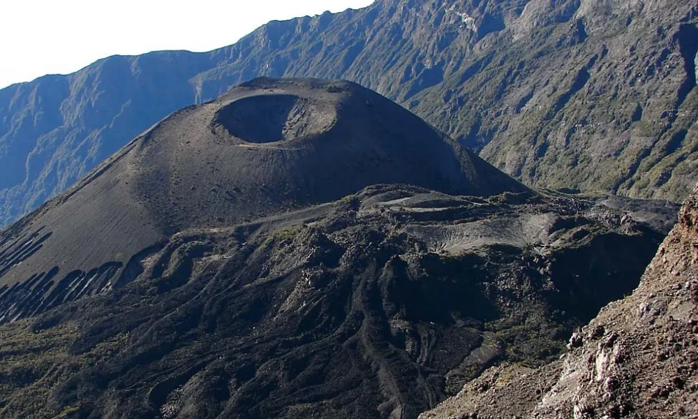
The Meru Crater
At the heart of Mount Meru lies the Meru Crater, a large depression formed by collapsed volcanic activity. The crater is surrounded by steep walls and contains fertile soils, streams, and occasional small lakes.
Hikers ascending the mountain will notice:
- The sheer crater walls visible from various viewpoints
- Volcanic rock formations with unique textures and colors
- Evidence of past eruptions in the form of ash layers and boulder fields
This area provides a tangible connection to the mountain’s violent geological past.
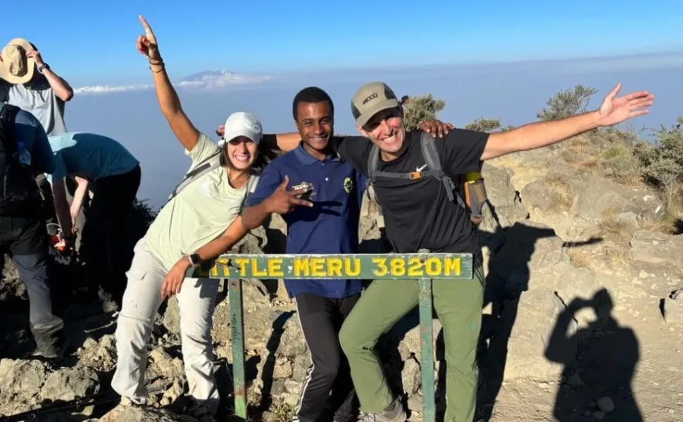
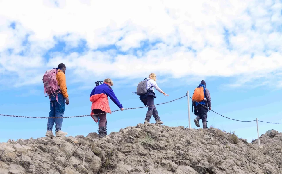
Little Meru: A Secondary Peak
Adjacent to Mount Meru is Little Meru, a smaller volcanic cone formed from separate eruptions. It serves as a popular acclimatization hike for trekkers and offers spectacular views of the main crater. The presence of Little Meru illustrates how multiple volcanic events shaped the landscape, creating ridges and valleys that define the trekking routes today.
Volcanic Soil and Its Ecological Impact
One of the lasting effects of Mount Meru’s volcanic activity is the fertile soil on its slopes. Rich in minerals like potassium and phosphorus, this soil supports:
- Dense montane forests on the lower slopes
- Unique alpine flora such as giant lobelias and Helichrysum
- Grasslands and wetlands that attract wildlife
Without its volcanic foundation, Mount Meru would lack the biodiversity and greenery that make it such an extraordinary trekking destination.
Recent Geological Activity
Mount Meru is considered active, though its last major eruption occurred in the 20th century. Hikers may notice:
- Steam vents and hot soils in some crater areas
- Fresh lava rocks on higher slopes
- Evidence of minor landslides and ash deposits
While eruptions are rare, the mountain’s volcanic features remain a reminder of its dynamic nature.
Why Volcanic History Matters to Trekkers
Understanding Mount Meru’s volcanic history enhances the trekking experience by:
- Highlighting geological landmarks such as craters, lava flows, and ridges
- Explaining ecological diversity, including plant and wildlife distribution
- Providing photography opportunities among dramatic volcanic landscapes
- Deepening appreciation for the power of natural forces shaping East Africa
Book a Guided Mount Meru Trek With Tanzania Hiking
Tanzania Hiking offers expert-led treks that explore Mount Meru’s volcanic history safely. Our guides highlight crater features, lava formations, and geological hotspots while ensuring proper acclimatization and trekking safety.
- Email: info@tanzaniahiking.com
- WhatsApp: +255 752 213 715 / +255 754 557 877
Request a Quote for Your Volcanic Adventure
Want to experience Mount Meru’s volcanic wonders firsthand?
Fill out the quote request form below, and our team will craft a custom trekking itinerary that combines scenic viewpoints, geological landmarks, and safe summit attempts.